Wednesday, March 25, 2020

Brian's Ghost Town Safari #2: Monte Cristo


Although I’ve always loved a picturesque ruin, Monte Cristo was my very first ghost town. This time last year I was living in Seattle, understandably bored; when I heard about an abandoned gold mining camp in the mountains nearby, I knew I had to take a look.

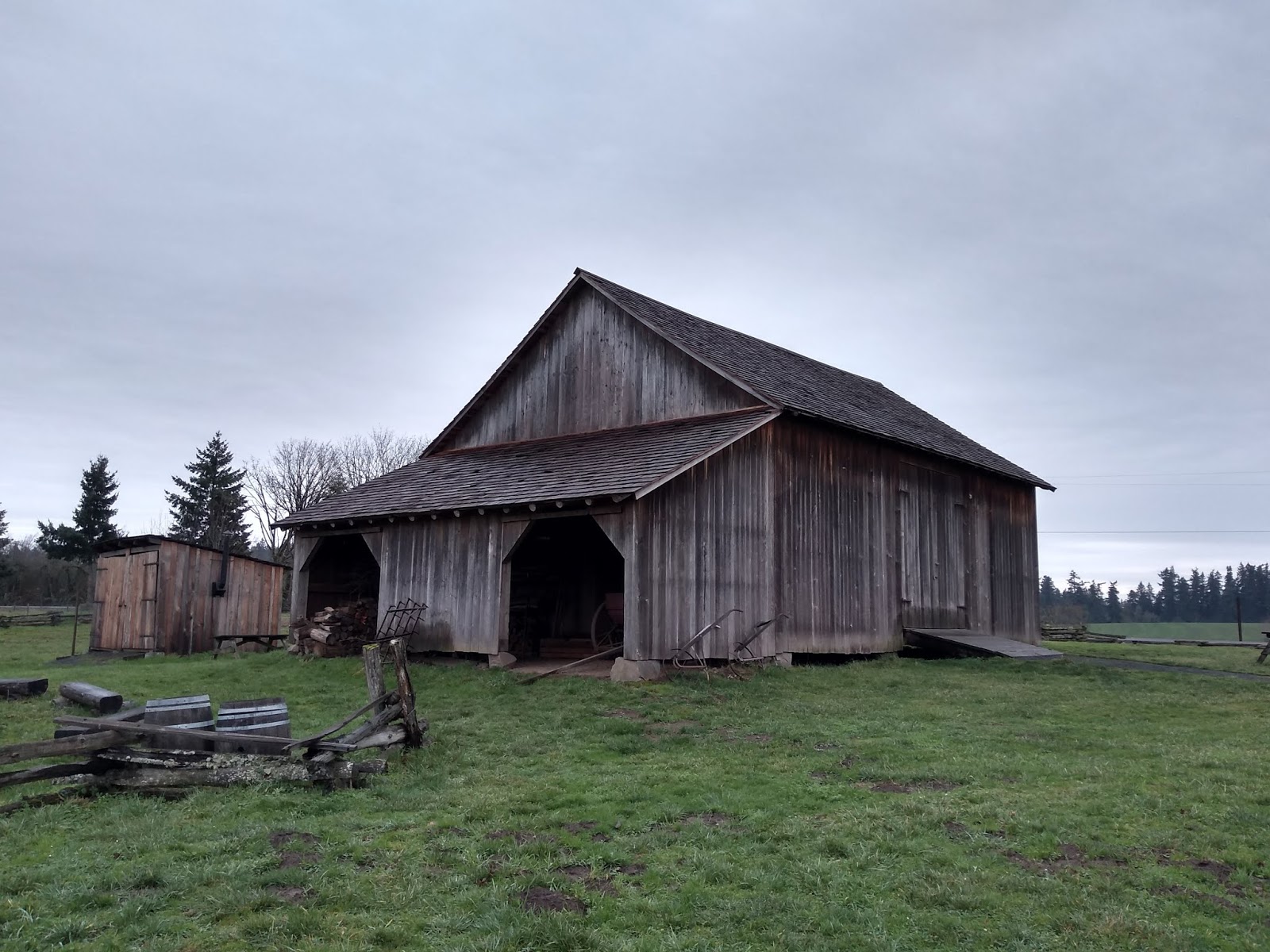
Fig. 5.1: Metal-sided garage, the oldest surviving building in Monte Cristo.

Western Washington isn’t usually associated with gold mining. You might expect a ruined prospectors’ settlement in the Sierra Nevada or the wilds of the Yukon, but not just outside the Puget Sound megalopolis – everyone knows that business around there is all trees and tech. But for a brief moment in the late nineteenth century, the desperate and credulous flooded up the South Fork Sauk River to stake their claims on a supposed fortune in gold. Unfortunately for them, it didn’t quite pan out. Pun intended.

Monte Cristo, Snohomish County, WA
est. 1893, abandoned 1980

Gold and silver were struck at the headwaters of the South Fork Sauk in 1889. At this point, though, the area was just too rugged and remote to exploit without some serious investment. The goldfields lay fifty miles east of the port at Everett, and the men who found them had to go cap in hand to East Coast industrialists in order to secure funding for a railroad. John D. Rockefeller – the Standard Oil monopolist who was at this point reaching his apogee as the richest human being in history – was one of those who lent out his capital. The tycoon’s name was magnetic and once it emerged that he was funding the project, thousands of people began trooping up the Sauk to file their own claims, sure that Rockefeller couldn’t pick a bad bet.

The Eastern investors and lone prospectors alike dug their mines high in the mountain peaks, and cable cars were built to lower the ore into the valley below for processing. A village soon sprung up around the mills and concentrator at the headwaters of the Sauk. Monte Cristo was a typically seedy boomtown full of grifters eager to “mine the miners.” The venality, violence, drunkenness and sexual exploitation were probably as bad as what you see today in the fracking camps of Canada and the Dakotas; it’s what happens when there are lots of single men making money very quickly in isolated surroundings. The only difference was Monte Cristo’s literary pretension. The main drag was Dumas Street, and the intersecting avenues had names like Mercedes and Dantes.

Fig. 5.2: Monte Cristo in 1895, looking like a big snowy logjam.

The most famous of Monte Cristo’s crooked merchants was one Frederick Trump, a Bavarian immigrant who had fled to America to evade the draft. In the 1890s, he was living in Seattle, where he ran a combined diner, saloon, boardinghouse and brothel called the Dairy Restaurant. When he heard about the strike on the Sauk, he figured astutely that the only people who usually get rich out of a gold rush are the outfitters and pimps. (This is a lesson I had hammered into me again and again living in Seattle, which first really prospered as a metropolis by fleecing would-be prospectors heading to the Yukon.) Moving to Monte Cristo, Trump jumped somebody else’s claim and built a “hotel” (read: brothel) on his squatted property. Despite being an obvious crook, he became the town’s most prominent citizen, and he was soon elected justice of the peace. If the story sounds familiar, it’s because his grandson Donald managed a similar trick on a grander scale a century later.

Fig. 5.3: Frederick Trump, patriarch and pimp.

Life in Monte Cristo was never pleasant and it soon grew worse. Rockefeller took greater and greater control of the town, elbowing out the other investors and cracking down on labor agitation. The heavy annual rain- and snowfalls destroyed rail lines and buildings every winter, making the mere survival of the town Sisyphean. Worst of all, after only a few years it became clear that the gold deposits were much more meager than initially thought – not to mention heavily leavened with naturally occurring arsenic.

By the turn of the 20th century, many of the town’s residents, including Frederick Trump, had abandoned ship. (Trump went on to repeat his Monte Cristo business model during the Yukon gold rush. He became a wealthy man and moved to New York to start a family. The rest is, unfortunately, history.) In 1903, Rockefeller and his underlings sold the entire mining operation to the American Smelting and Refining Company. ASARCO, the source of the Guggenheim family fortune, is now primarily known as one of America’s worst industrial polluters; fully twenty of its former properties are now Superfund sites and it has been held liable for negligently poisoning dozens of communities across North America with lead and arsenic emissions. As I’m sure you’ve noticed so far, this is an extremely Gilded Age story.

The only part of the Monte Cristo operation the Guggenheims really wanted was the smelter at the end of the railroad line in Everett. (It’s now one of their twenty Superfund sites.) The town was surplus, and was treated as such. Monte Cristo dwindled to a ruin. In 1920, the last operating mine was buried by a massive avalanche.

However, the end of one industry was the birth of another. With its beautiful mountain setting and backdrop of romantic ruins, Monte Cristo became a resort attraction almost immediately, and remained so for much of the twentieth century. The hotel was renovated and opened for motorists touring the newly built Mountain Loop Highway. Visitors could stay in cabins and enjoy the area's hiking trails; the town is adjacent to the Gothic Basin, which is supposed to be spectacular. Its remoteness and the yearly weather damage, however, soon took its toll. By 1980 the resort had deteriorated into a shabby mess at the end of a long, poorly maintained track; that year, a heavy flood of the South Fork Sauk washed out the road link completely and the county refused to rebuild it, effectively terminating Monte Cristo as a habitable community. Three years later, the abandoned lodge burned to the ground. Looters and treasure hunters ripped up most of what was left.

Fig. 5.4: Vacation cabins and mining debris at Monte Cristo today.

Through the efforts of concerned locals and the Trust for Public Lands, the townsite was eventually transferred to federal ownership. The US Forest Service became the official custodians of the surviving vacation cabins, thousands of pounds of ruined mining equipment, and several mines and their associated piles of arsenic-contaminated tailings. A few houses on the edge of town, however, remained in private hands. The site is now being actively preserved through a public-private volunteer partnership.

My friend and I visited on a mild, overcast day in early June. We parked at the Gothic Basin Trailhead and attempted to find the trail to town. Unfortunately, there have been so many separate roads built through the valley, and the course of the South Fork Sauk has changed so many times, that we ended up just walking up the stony riverbed most of the way. As we hiked the four miles in, we spotted the washed-out county bridges – now sitting useless in the middle of the river – and began to see scraps of the old mining railroad exposed among the rocks.

Fig. 5.5: A path.

A little later, we passed a denuded hillside above the river. A sign identified it as “The Repository.” The Forest Service had finally buried the last of the poisonous mine tailings under this slope in 2015. The decontamination project had required waiving laws in order to construct a heavy trucking road through the Henry M. Jackson Wilderness, which surrounds the Monte Cristo townsite. Building a necessary road in a necessarily roadless area is a classic example of the contradictions sometimes inherent in caring for our environment and fixing humanity’s mistakes. Once, while working on a trail crew, I was asked to fell an enormous old-growth tree – an organism probably 300 years old. We were using it to build a series of puncheon bridges on an impassably boggy section of wilderness trail. Normally, I’d see cutting old-growth in this day and age as blasphemous and disgusting. But there was no way to pack construction materials for the bridges into the backcountry, and if we hadn’t built the bridges hikers and equestrians would have fanned out across the area to evade the bog, creating desire paths, trampling vegetation, and causing erosion. Did we do the right thing? These are the kind of difficult calls land management professionals have to make daily. (I’ll have to talk more about the experience of felling a tree in a later post.)

As we got to the four-mile mark, we were surprised to find a modern house, complete with satellite dish and a truck outside! A sign explained that there were still a few private “donut hole” inholdings on the edge of town, and reminded us to keep to USFS property. It seems absolutely inconceivable that someone could live there. I don’t know how you could get even a robust 4WD truck up the riverbed, but I guess if you had a house here before it became inaccessible, there wouldn’t be any way to make a profit by selling it, so you might as well keep it as an off-grid vacation property.

The ghost town proper started a little further on. Someone had set out the old lodge sign as a welcoming signpost. After passing it, mine carts and other bits of debris started appearing in the underbrush. The vacation cabins, of which there are maybe a dozen or so, began in a clearing, alongside an enormous (and still functioning!) railroad turntable.

Fig. 5.6: We didn't touch it, but when we passed by on our way out some young kids were spinning it around, without even a rusty squeak.

The foundations of the burnt-out lodge were a little further back into the woods. There was no trace of the concentrator, Trump’s brothel, or most of the other 19th-century buildings. Only one structure from the gold camp era, the garage pictured above, is still standing. Walking up to the trail signposted “Dumas Street” you can see why. There are some plaques denoting where major structures used to be, and in a lot of cases there's nothing behind the sign but a sheer drop. The destructive power of nature is palpable all throughout the valley. I’m sure if I visited again in twenty years, the landslides and floods would have made the landscape visibly different.

Monte Cristo is a pretty standard example of my vague ghost town hypothesis: communities created by the profit motive in defiance of environmental conditions are not sustainable in the long run. But on the other hand, in terms of its unusually intact buildings and its wealth of well-preserved artifacts, it’s an exceptional standout and well worth a visit.

Monday, March 16, 2020

Brian's Ghost Town Safari #1: Champoeg


If you think Americans today move around a lot, try reading Honey in the Horn by H. L. Davis. He portrays the twentieth century dawning over a population completely adrift. In Davis’s Oregon, caravans of fortune-seekers, entire towns’ worth, pour over the mountains from West to East and back again seeking better land. Schemers plot out competing, fantastical cities on paper in order to win the favor of the railroad surveyors. The novel’s young protagonists, Clay and Luce, join crowds of itinerant laborers, hop-pickers, farmhands, and outlaws who pass by each other again and again on the backroads of a country already half-abandoned.

In a lot of ways, the book is about the stubborn refusal of Western settlers to truly settle – to adjust to their new environment and build a community of dwellers in the land, instead of just constantly looking for greener pastures. One throwaway joke line which stuck with me comes from Clay and Luce’s time on the coast. After living off the bounty of the land for months, they stop at a hotel in Coos Bay on their way inland which has a different culinary philosophy. “The next morning there was a restaurant breakfast which, because the natural products of that country were beef, elk, venison, honey, wild-fowl and two hundred species of edible fish, consisted of ham, eggs, pancakes and maple syrup.” No locavores, these pioneers!

(I have tons to say about the book, it’s really snidely funny and is one of my all-time favorites, please get @ me in the comments if you’ve read it and pick it up if you haven’t.)

Fig. 4.1: It's not quite as sexy as this cover makes it look, although it has a couple moments.

Davis’s observations about the transience of settlement in the American West are spot on. This side of the Mississippi, the continent is scattered with hundreds of ghost towns. Each one was once people’s home, before something – usually, from what I’ve seen, the profit motive running up against environmental conditions and creating disaster – forced the residents back on the road. People ate ham instead of fish, or whatever, and disaster followed. Residents scattered, and in many cases, thriving communities ceased to exist overnight. It was a level of mobility and instability hard to imagine even today.

I’ve been fascinated by ghost towns for a while, but I’ve recently started actively seeking them out, and I plan to record my finds on this blog. I’ve visited eight or so thus far in Oregon and Washington, and I have many more lined up – there’s no danger of running out.

Oregon is thought to be the nation’s ghost town capital, although counting ghost towns is practically impossible since there’s no strict definition of one. Some places popularly deemed ghost towns are thriving villages whose population has merely fallen from boomtown heights. Others are areas of wilderness with not a crumb of rubble to be seen. Very few are clusters of intact, standing, and completely vacant buildings, although of course those are the most fun. One website I’ve found uses lists of extinct post offices to estimate an Oregon ghost town count of over 1,600. However, that list includes places like the city of Albina, which was incorporated into Portland and still exists as a neighborhood, so it’s probably way too expansive.

In any case, this isn’t really a catch-em-all hobby; it’s a way to get outside, see new places off the beaten track, and learn some history. Let’s start with my New Year’s visit to the granddady ghost town of them all…

Champoeg, Marion County, OR
Est. c. 1829, abandoned 1861

Fig. 4.2: Bustling downtown Champoeg, pictured from the corner of Napoleon and LaSalle.

Now, Champoeg wasn’t the first settlement in what was then called the Oregon Country. Astoria had been founded in 1811, and the Hudson’s Bay Company had already begun building its network of trading posts – and there were hundreds if not thousands of Native towns and villages scattered across the country from the boreal forests to the high desert. When French-Canadian HBC trappers arrived in the Willamette Valley, they encountered temporary Kalapuyan encampments along the river, including near what became Champoeg.

If the trappers had asked, they might have been told that building a permanent village at the place the Kalapuya called čʰámpuik wasn’t the soundest idea. Naturally, they didn’t ask.

Today, the uninhabited floodplain is designated as a State Heritage Area. I visited on December 30th, at the tail end of 2019. It was one of those days when you really, really need to get out of town and see some green along with the gray. I got a pleasant surprise on the way over when my GPS informed me that the village’s Anglicized name is pronounced “shampooey.” “CHAMPOEG FOR MY REAL FRIENDS, REAL POEG FOR MY SHAM FRIENDS,” I yelled at the steering wheel. (I do a lot of enthusiastic yelling when I’m driving alone.)

The Newell House, a Champoeg-era home and museum not far from the townsite, was closed that day. It’s privately run by the Daughters of the American Revolution, and they do what they want. The state park, though, was wide open for the curious.

Writing thirty years ago, travel writer Ralph Friedman described the park’s Visitor Center as one of the best museums in the state. His claim holds up, although I assume a lot of the digital interactivity came after he drove through. I was outnumbered by friendly docents and given free rein to explore.

The story of Champoeg – and the reason it’s a State Heritage Area, unlike most of the other sites I’ll be covering – is really the story of how Oregon went from a being a Mad Maxian free-for-all to having an organized government. In the early 1840s, the “Oregon County” was just a set of lines on a map. There were people here, and there was a thriving Cascadian biosphere that roughly overlapped with those artificial lines, but there was no polity to speak of. Under the terms of an 1818 treaty, the area was “jointly occupied” by America and Britain, but that didn’t mean anything in practice – neither country collected taxes, provided services, or really exercised any control there at all. The native nations that had traditionally owned the land were undergoing hideous demographic and societal collapse from epidemic diseases, not that the rising tide of white settlers would have abided by their laws anyway. It was a total power vacuum.

Fig. 4.3: Map of the Oregon Country showing competing American and British claims and the network of HBC trading posts. Image created by user Kmusser on Wikipedia, licensed under the Creative Commons Attribution-Share Alike 2.5 Generic license.

The closest thing to a ruling power in the Oregon Country was the Hudson’s Bay Company. A fur-trading monopoly that owned much of what is now Canada, the HBC was supposed to be an arm of the British crown but in practice operated independently like a cyberpunky corporate government, with its own money and its own courts. Its trading posts were the main centers of power in the region, and its Chief Factor John McLoughlin, based at Fort Vancouver – today’s Vancouver, Washington – was half-seriously called the “King of Oregon.”

(In case you’re curious, the HBC lost its government monopoly and its quasi-statehood in 1869 but kept on trucking; it currently exists as a bougie department store chain in Canada. They bought Saks Fifth Avenue in 2013.)

Along with McLoughlin and his underlings, there were a few hundred settlers living in the Willamette Valley. Many were former HBC employees of Québécois or Métis origin who had left the company’s service to build lives of their own. Some were affiliated with the Methodist Church, which had sent a mission to minister to the native population. Others were independent Anglo-American homesteaders who harbored hopes that this land would eventually become US territory.

Before long, this scattered community of rugged individualists started to run into the kind of problems that required a legal framework to deal with. A man named Ewing Young died without heirs, leaving behind an enormous herd of cattle and a profitable sawmill for his neighbors to fight over. Wolves and other predators attacked livestock and required collective action to fight off. Somebody committed murder. At first, these issues were dealt with via ad hoc meetings, but soon the settlers of the Willamette Valley began to realize that – as we say – they lived in a society.

In 1843, about a hundred people convened at Champoeg to discuss forming a government. The tiny settlement, at this point consisting of little more than an HBC grain warehouse, was the most central and convenient gathering point in the territory, and men rode in from distant farms for the meeting.

The debate over organizing a government had already developed along national lines. Most of the Americans resented the power of the Hudson’s Bay Company and mistrusted the Catholic, Francophone John McLoughlin. Some wanted their own government in order to prepare for annexation by the United States, while others dreamed of an independent Pacific Republic, but they were united in their belief that some kind of civil authority was necessary. The Canadiens, on the other hand, were concerned about the legal implications of instituting a government. Would they be considered rebels against the British crown if they voted in favor? If Oregon was annexed by America, would they be granted citizenship, and would they be granted title to their land? (Remember, without laws, everyone was effectively squatting on stolen property at this point.)

Fig. 4.4: Joe Meek raises a point of parliamentary protocol with his coonskin cap.

According to legend, it was Joe Meek who forced the issue. Meek, a onetime independent trapper and “mountain man,” had settled in the Tualatin Valley with his Nez Perce wife and children a few years earlier and enjoyed wide respect among both the American and Canadien communities. As the debate dragged on, Meek grabbed a stick, drew a line in the dirt and said, in a weird mixture of call-to-arms and Robert’s Rules procedurese: “Who’s for a divide? All for the report of the committee and an organization follow me.” The men formed up on either side of the line, and the vote was tallied: 52 for, 50 against. The Oregon Provisional Government was born.

As I’m sure you’ve noticed, the whole story has an odor of patriotic foundation myth to it. It may have been set up that way intentionally by the pro-government side: Ralph Friedman refers to Meek’s theatrics and the vote as a “well-organized spontaneous demonstration.” This was an era when the small communities of white people on the frontier thought of themselves consciously as historical actors and believed their personal choices could shape the lives of millions of people yet unborn.

I stepped out of the Visitor Center, exchanging some cheerful Happy New Years with the docents, and started down the hill to the floodplain and the site of that fateful vote.

In the wake of the vote, Champoeg grew slowly as power and population concentrated in Oregon City upriver. The town at the falls of the Willamette was soon the Provisional Government’s meeting place and the center of all business and political activity, and would remain so until American annexation in 1848 and its eventual eclipse by Portland and Salem. By 1860, Champoeg was a backwater, with a population of about 180 and a small economy based on the warehousing and shipment of grain. The village might still exist today as a quaint tourist attraction… if its founders had platted on higher ground.

Today, the Willamette’s volume and flow are controlled by a score of dams. Like most of the nation’s major rivers it is a combination power generator, irrigation ditch, and freight highway, run like an organic machine by a half dozen governmental agencies. But in the mid-nineteenth century, it was still wild, and in particularly wet years, it would flood – sometimes spectacularly. 1861 was one of those years. That spring, the snows in the mountains melted, the rain poured down, and the river rose, overtopping the banks and scattering the rude wooden buildings of Oregon’s first capital.

This is why the Kalapuya hadn’t built permanent settlements right on the riverbanks.

No one was killed, but the village was completely destroyed and was never rebuilt. Today, what was once downtown Champoeg can only be identified by the hollow courses of its streets and by a series of regularly spaced wooden posts, each one marking the location of an intersection.

Fig. 4.5: Looking down Napoleon Street, the main drag. Some of the roads were named after French national heroes, some after American presidents – Champoeg was an international community.

The day I visited, the townsite was mostly deserted, and the river lay low and leaden below the banks. A few old couples walked dogs along the paved paths. I tried to follow the old streets, and the tall grass soaked my pants. Just west of “downtown,” the ground rose slightly to a plateau forested with enormous trees. Apparently, this is where the fateful divide took place all those years ago.

Two Canadiens, Étienne Lucier and François X. Matthieu, had been the swing votes that day – they’d joined the Americans in voting for government while the rest of their countrymen voted against. Matthieu, a carpenter, was a political fugitive and a longtime admirer of American law and values. He’d been involved in the 1837 Lower Canada Rebellion against British rule over Québec, and after its failure had spent the intervening years hiding out on the frontier. Lucier, a former HBC trapper, was a founder of Champoeg and may have been the first white settler in the Willamette Valley. He was less radically inclined, but over the previous winter, he and Matthieu had become close friends. In the latter’s memoirs, he recalls winning Lucier over to his brand of pro-American republican politics – and thereby takes credit for deciding the vote and creating the Provisional Government.

Subsequent generations of Oregonians took Matthieu at his word. By coincidence, he happened to live longer than any other participant in the meeting, and until his death in 1914 he was celebrated as the “hero of Champoeg” who “saved Oregon for the United States.” In 1901, forty years after Champoeg’s destruction, Matthieu returned to the townsite amid pomp and circumstance to dedicate a memorial to himself and the others who voted with him.

Fig. 4.6: Supposedly, the little obelisk sits exactly where Joe Meek drew his line in the dirt, although they were working off of the octogenarian Matthieu’s memory when they erected it so I’d take that with a grain of salt.

Let’s assume the story is true and that Matthieu really did swing the vote. Did that act alone “save Oregon for the United States”? I’m not much of a Great Man historian, and I suspect that the outcome would have looked the same no matter what the tally had been that day. There were more and more Americans coming into the Oregon Country every year, while the HBC was already losing its sway in the British Empire and would have trouble getting any government backup for its interests. The demographics made the formation of a government only a matter of time; if it didn’t happen at Champoeg that day it would have happened the next time the settlers convened to solve a problem.

The more interesting question is what that government’s purpose would have been. Most of the Americans involved in the Provisional Government saw it as a step towards annexation, and indeed that’s what happened; Britain and America finally divvied up the region and by 1848 began exerting state power. But there was also a faction led by mountain man Osborne Russell that advocated dropping the “provisional character” of the government and declaring a free Republic of Oregon. The idea was that both the American and British metropoles were too far away to govern the country effectively, and that the community of settlers had already organized themselves as a sovereign body, drawing political legitimacy only from themselves. Russell ran a close second in the Provisional Government’s first gubernatorial election. Even John McLoughlin started expressing interest in independence as his influence with the British government collapsed. However, every successive wagon train brought more American patriots, and Oregon independence soon became a fringe idea.

An independent state in the Northwest may not have been a total impossibility, though. In the 1840s, there was still widespread anti-expansionist sentiment back in the United States, usually coming from Whigs who predicted (correctly) that it would inflame tensions over slavery. President James K. Polk, whose political project the Oregon Treaty was, was only elected by a hair. If a different American administration had disclaimed interest in the territory, maybe the jilted settlers would have been more interested in Russell’s ideas. An 1840s Oregon Republic would be no Ecotopia, of course; it’d be a violent settler state just like the Republic of Texas or like America itself. But in the longer term an independent Oregon may have been able to avoid the extractive, quasi-colonial relationship with the industrial East which the American West had to endure in our reality...

(As a side note, President Polk was married to Joe Meek’s cousin. I know the population was drastically smaller back then and everybody knew each other, even Presidents and mountain men, but I kind of want to believe that this is evidence that the Champoeg meeting was part of a long, stage-managed American imperialist conspiracy. It would make a fun Pynchon novel or something.)

I headed back upland. There was one part of the park left to see.

Fig. 4.7: Not gonna lie, this barn got me excited.

Outside the Visitor Center stands Champoeg’s only surviving building. The barn, raised by pioneer Donald Manson and his family immediately before the flood, was knocked off its foundations by the rising waters, but it was washed up downstream intact and was eventually hauled to higher ground and restored. There are a few other artifacts remaining: scraps of pottery and other archaeological remnants can be seen at the Visitor Center, and active archaeological work on the townsite is ongoing. Additionally, the community’s church bell was salvaged from the river and is now in use at the chapel in Butteville, just down the road.

Seeing the bell would have been the logical next stopping point had I planned this trip in advance and not driven down in the afternoon on a day when everything was closed. I may have to go back, see the Newell House, and slide into Butteville to check out the church and buy a Gatorade at the oldest operating store in Oregon. (Butteville’s bodega was founded in the 1860s by none other than François Matthieu.) Hit me up if you want to come – I’ll be ghosting every weekend.

Tuesday, May 7, 2019

Primitivism and Deep Ecology

This fortnight's post is a little different. Among the many fascinating blog series over at Sea Lion Press, home of alternate history publishing, is one by their author David Hoggard examining unsuccessful or fringe political ideologies. I contributed a guest article to the series this Friday (Other Ideologies: Primitivism), and I thought I'd link it here.

The notion that industrial civilization is not worth the benefits didn't originate here in the Northwest. Nor is its story confined here. Yet while researching the article, I returned to our neck of the (old-growth) woods time and time again. Earth First!, the ecological monkeywrenchers who gave us tree-sits and tree-spiking, did some of their most famous work in the timber belt of Oregon and Northern California. Their descendants in the ELF torched McMansions and GMO crops in the suburbs of Portland and Seattle. John Zerzan, the original anarcho-primitivist, lives and teaches in Eugene. A little further inland, in the mountains of western Montana, Ted Kaczynski hid from society as he built his bombs.


One of the central paradoxes of the Northwest is that we are close to, and often reverent of, nature and yet the economy built here after white settlement has been dominated by extractive industry. That is not an irreconcilable conflict - as I'll cover in later posts, loggers have often considered themselves stewards of the land - but it is difficult to deal with for many people. It's easy to feel disgust and anger at the sight of clearcuts or dams or vistas of suburban shitboxes encroaching on what still feels like a very wild place. Combine that with the Western USA's history as a breeding ground for wild ideas of all political stripes and you get the perfect recruiting ground for anti-civilization radicals.

That's my psychoanalytic introduction - now pop on over to Sea Lion Press and learn the harder facts.

Monday, April 22, 2019

Thornton Creek


Every place has its story. Even the suburbs.

I live a few blocks inside Seattle’s city limits. The double yellow line on NE 145th St separates the Emerald City from the quiet residential community of Shoreline, and even downtown Lake City has a strong suburban flavor to it. The area just south of the neighborhood was home to both an elaborate Prohibition-era speakeasy operation and a historic civil rights campaign against a racist restaurant, both of which I’ll be writing about in future posts. But Lake City proper’s main claim to fame is hosting some of the oldest continuously operating dive bars in Seattle. There won’t be a period drama set here anytime soon.

History isn’t just thrilling stories, though: it’s about how people have lived and worked and loved and struggled every day. Instead of tracing a narrative story, this week I decided to take a walk that would show me new parts of my neighborhood and allow me to give some little vignettes about what Shoreline and North Seattle are like, and how they got that way. I was going to follow Thornton Creek.

Fig 3.1: It was also a really nice day out, so I needed an excuse for a walk.
Thornton Creek drains twelve square miles of city and suburb in Seattle and Shoreline, including almost all of Lake City. After an intensive restoration campaign in the 2000s, about ninety percent of it is aboveground, which is pretty remarkable for an urban river and makes it easy to walk along even when it disappears into private property. One branch flows from Shoreline south, the other flows east from underneath the Northgate Mall, and they converge in a specially constructed flood-control park before issuing into Lake Washington at Matthews Beach. I couldn’t follow both routes, but the North Branch was the obvious choice. Northgate is about as historically interesting as a mall can get – it was one of the first enclosed shopping centers in the United States, and Ted Bundy used to pick up his victims in the parking lot – but that’s still not saying much, and besides, the route of the North Branch is longer and more varied. I got on the bus and headed to Ronald Bog Park.

The Thornton Creek Watershed is originally home to the Xacuabš (Lake People), now part of the Duwamish tribe. A village was located on the lake at the mouth of the creek, the bogs at the creek’s headwaters were harvested for cranberries, and controlled burns were used to create hunting meadows all across the watershed. If you’re ever in the area, the Shoreline Historical Society has a beautiful hand-painted map of North Seattle as it appeared before colonization, which is worth the visit alone.

The Xacuabš were dispossessed and driven off their land by white settlers in 1854, and since then the story has been one of continuous construction and rising population density. The latest chapter was visible immediately when I arrived at Ronald Bog Park.

Fig. 3.2: Notices of Proposed Land Use Action are the Seattle area’s answer to red phone boxes or Benson Bubblers.
Two signs, listing far out into the sidewalk, notified passersby that the park will be undergoing some changes. A good chunk of it will be converted into artificial wetlands in order to “mitigate” the destruction of wetlands elsewhere. In a few years’ time, city engineers will be laying light rail tracks along the other side of the freeway, grubbing up boggy habitats as they extend the train up to Shoreline. Even development that’s good for the planet in the long run, like public transit infrastructure, can be pretty destructive in the moment.

Ronald Bog Park was quiet this Sunday afternoon. A couple snoozed on the grass. Ducks paddled on the water. An old man with a beard and bucket hat cooled his feet in the pond, Thornton Creek’s headwaters springing up between his toes. The cherry blossoms were out.

 You wouldn’t know it looking at the smooth green lawn, but this area was once a true cranberry bog, covered in peat moss and grazed upon by deer and bears. In the 1940s, a peat mining operation dug up most of the moss (leaving a hole that the pond fills today), and within a few years it became an urban wilderness, overgrown and contaminated by spillover from the Shoreline dump then located immediately to the south. It wasn’t until the 70s that neighbors got it cleaned up and parkified.

I hoped to find a way out through the park to the south, where Thornton Creek emerged from the pond, so I plunged into the remaining overgrown boggy area on the eastern edge, up against the highway. The ground bristled with poky dead reeds and Himalayan blackberry. A collapsed barbed-wire fence no longer marked the boundary between park property and the domain of the Department of Transportation; the highway was so close that I could’ve scrambled up and stood on top of the concrete berm. I couldn’t see a way south. The tents and tarps of a small encampment were visible through the trees in this jurisdictional limbo, complete with a handmade bridge across a drainage ditch and gates built from orange construction webbing. Even here, eleven miles from downtown Seattle, the housing crisis is plain as day.

Fig. 3.3: A quiet corner of the park.
I decided I’d have to circle the park instead. Back on N 175th St, a gargantuan sign welcomed me to the City of Shoreline, Incorporated 1995. Incorporated 1995 it might have been, but this has been a commuter suburb since long before that date. The interurban from Seattle to Everett used to run right through this neighborhood. Like so many other transit systems of the early 20th century, though, it fell afoul of mismanagement, the Depression, and – if you believe the story – General Motors’s nefarious plot to wipe out trolleys across the nation. Ronald Bog was de-bogged by the development generated by one light rail line, and is now being re-bogged to mitigate the construction of another. It’s a neat little historical poem.

Fig. 3.4: You can tell I posted this a little late. The park's statues were still dressed up for St. Paddy's when I went through.
South of the park, Thornton Creek begins its flow underground. I walked along Meridian Ave, dipping in and out of tidy culs-de-sac that had once been dump, but not seeing a sign of the stream yet. People were out working on their cars or yards in the sun. A girl was biking in circles in the street; a few blocks over, a bald man was doing the same. Every other household seemed to have a home improvement business: there were vans belonging to plumbers, landscapers, solar panel installers and even a chimney sweep. On Corliss Place, I finally spotted the creek bed running through a landscaped front yard.

Just as it hits daylight, though, Thornton Creek disappears again into forbidden property: a tangled stretch of woods posted with NO TRESPASSING and NO DUMPING signs. Through the trees, I could see the low bulk of the Shoreline Recycling & Transfer Station. Not wanting to have to circle around on Meridian again, I looked for a back way in, but all I found was a cell tower and a desolate park.

Fig 3.5: Fifteen-foot trees growing through the tennis court at James Keogh Park.
The signs on the other side of the woods, by the bustling entrance to the recycling station, caught my eye. One was dotted with lichen devouring the black paint of the letters, while the other had the pre-2006 insignia of King County on it.

King County was organized in December 1852 and named after then-Vice-President-elect William Rufus DeVane King. A Southern plantation owner and slaveholder, King is best known for founding Selma, Alabama, and for probably being James Buchanan’s lover. (The two men spoke about each other in terms that would be sweetly endearing if they weren’t the people they were.) King was dying of tuberculosis in Cuba when he won the election. He expired only two days after returning to the United States. As a closeted Romantic consumptive and a hideous racist, King is probably our most nineteenth-century Vice President.

It took 134 years for Seattle-metro officialdom to recognize that honoring a proud defender of slavery wasn’t a very good look. The solution was brilliantly simple: they kept the name King County, but proclaimed that it now referred to Martin Luther King, Jr., instead. It was another 20 years before they got the designation officially recognized by the State of Washington and the logos updated to match. I’m almost certainly going to do a post on the Guerrilla Theater of the Absurd when I get back to Portland, and you’ll see how surprisingly controversial honoring MLK could be in the 90s.

(The county councilman who led the renaming effort, by the way, was Ron Sims, who later served as Obama’s HUD secretary and ran for Governor on a platform of fixing Washington’s grossly regressive tax system – unfortunately he was less successful in the latter effort.)

Fig 3.6: Urban wilderness.
Thornton Creek runs somewhere underneath this zone of civic infrastructure. I walked through a grassy park bounded by the Metro bus garage and a clutch of humming electrical transformers, my eyes peeled for open water.

As it turned out, I wouldn’t see the creek again for a while. It emerges on private property and remains there for the next mile, tracing a property line between people’s backyards and the interstate. As I walked through more suburban streets, smiling at the cherry blossoms and getting scowled at by two men washing a vintage car, I spotted snatches of ivy-coated gully behind fences. I was too far back to see the flowing water, and it was too close to the interstate to hear it.

The creek became public property again in Twin Ponds Park. Now this place was bustling. A junior soccer game was in progress. Less competitively inclined kids were scrambling over the huge banks of tree roots that lined the ponds. A dad was trying to play frisbee while smoking a cigarette: an athletic feat I hadn’t seen since college.

Fig. 3.7: A Twin Pond.
On the southern edge of the park, where the creek jogged back to join the freeway, I spotted the first signs of watershed volunteerism: the Washington Native Plant Society had been by to replace invasives. This walk could easily have been a trudge along a culverted dump, and the fact that it was a fun adventure instead is due to volunteer effort. If you're in the area, you can get involved with the Thornton Creek Alliance; if not, your local watershed probably has a similar group that could use your help.

Once I emerged on NE 145th St I’d reached the city limits. Seattle was right there on the other side of the street. The interstate was in sight, too, and I was about to get a new perspective on my local exit. Walking through highway infrastructure, even when it’s built with pedestrian accommodations, is always an uncomfortable and revelatory experience. It’s an ecosystem built for a different species, larger, louder, and tougher than human beings. I had diesel fume flashbacks to walking on the barricaded bridges during the anti-Trump rallies in Portland, and dodging big rigs on my way to work at a freight company off Columbia Boulevard. In my hustle across the overpass, I didn’t even stop to take a picture.

Catty-corner across the highway, I followed the creek down the edge of the Jackson Park Golf Course. The highway faded to a low growl and the scenery to pleasant monotony. On my left, a fence shielded me from errant balls; on my right, the creek ran by in the underbrush. I passed two joggers. Someone had chalked an enigmatic face on a beech.

Fig. 3.8: Shielded from balls and pinecones.
The creek eventually passed beneath me into the golf course, and I had to continue on alone until I reached Jackson Park proper. By the time we were reunited, the creek was lined with signs warning of invasive New Zealand mud snails. These tenacious bastards are about 1/5 of an inch long and are so tough they can survive passage through animals’ digestive tracts. They are hideously prolific. In New Zealand their numbers are kept down by an unlikely hero – a parasitic nematode called Microphallus which sterilizes snails – but elsewhere in the world they’ve become a hazard to local mollusks and to the fish that depend on them, including our own salmon species.

Here at the end of the golf course, the creek plunged into a deep gully of apparently public land; I tried to follow it but quickly got stuck in the mud. There was no trail here. Lost golf balls sank inexorably beneath the skunk cabbages. I scrambled up a slope, found myself in a community garden, kicked the mud off my shoes and headed onwards.

Fig. 3.9: No, I didn't pose the ball.
I liked the next neighborhood immediately. Technically, I live here, since the boundaries of the Olympic Hills neighborhood reach over to Lake City Way, but the enormous trees and pleasantly dated houses over here look nothing like the view from my apartment. I wondered idly if these trees might be old-growth that escaped logging because of the hilly terrain. Probably not. I spotted the only political sign of my walk here – a stakeboard for Trotskyite city councilor Kshama Sawant, who doesn’t represent this district – and one of the houses had an enormous, handmade wooden halfpipe in the driveway, disintegrating under a coat of pine needles. I’d like to settle down in a neighborhood like this.

Fig. 3.10: The Olympic Hills.
The creek had disappeared again, this time into a wildlife reserve that wasn’t open to the public, so I didn’t get another glimpse until it emerged from a condo parking lot at 15th Ave. From here on, it was visible in backyards and side yards, and unlike up in Shoreline it wasn’t buried in a government gully next to the highway. It divided some properties in two, and people had put up little bridges across it and pulled up lawn chairs beside it.

By the time I reached the commercial strip on Lake City Way there was already a blue note in the afternoon sun. The little wedge of park across from Wendy’s, where Thornton Creek plunged down into a ravine again, was almost twilit. This park was the first place I’d seen the creek when I first moved into the neighborhood, and it was as much of a hideous mess as always. Native plants choked out by Himalayan blackberry, branches hacked off to stobs, Fireball bottles and busted shoes and Top Ramen flung everywhere, Satanic glyphs painted on the trees. I assume that the little ravine park’s seclusion and its proximity to a big, filthy strip of fast food outlets means that cleaning it is a Sisyphean task for the Thornton Creek Alliance.

Fig. 3.11: I didn't stand in the grove for very long.
The creek runs under Lake City Way (under Pacific Northwest Flooring and its weird brick monolith, specifically) before plunging on into more residential neighborhoods. Lake City Way started life as a nineteenth-century logging road, and it’s still unusually wiggly for a major right of way.

Heading down NE 117th, now more than halfway to my destination and on a steep decline towards the water, I spotted the first really ugly houses I’d passed so far: skinny new builds with hard angles, gravel yards, and oddly scattered windows. I don’t need to include a picture. You know what I’m talking about.

What I do need to include a picture of is the sight that awaited me at the bottom of the hill: a giant vulva, kitted out for Saint Patrick’s Day and spouting out a stream of road reflectors. I’m not sure whether they’re meant to be love beads, a golden shower or a leprechaun’s treasure.

Fig. 3.12: The little text on the inside says "No New Taxes - Bush." Get it?
This incredible piece of public art is officially a commentary on the creeping forces of real-estate homogenization represented by the ugly houses up the street – the Showbox is a historic theater downtown, currently slated for demolition despite fierce protest from Seattleites, and the pun is obvious – but its origins are a little smaller-time. The owner was slagged off by his neighbors for leaving two giant stumps in his yard, so he decided to turn them into something they could really complain about.

A few blocks past the roadside attraction, I came to Thornton Creek’s confluence. The North Fork, which I’d just walked, and the South Fork, fed by parking lot runoff and the ghosts of Bundy victims, converge here in Meadowbrook Park. I’ll let Meadowbrook speak for itself. It was beautiful, and it’s the only park I’ve ever visited that requires a diagram to explain.


Figs. 3.13 - 3.15: Ahhhh.

By this point, my legs were getting sore. I’m not in great shape these days, and it felt good to have some muscles working besides my typing fingers. The sun was setting, and the neighborhood was quiet. A clutch of high schoolers were standing in a driveway, passing a basketball back and forth. As I passed, one was pretending to walk away in mock disgust at his friend’s joke. “Shit,” he realized, turning around. “I don’t have a car.”

A few more steep drops later and I hit Sand Point Way, North Seattle’s westernmost arterial, and only a block or two down that I spotted signs for Matthews Beach Park. Not too long ago, this was the site of the Xacuabš village, home to the people who walked the creek every day on their way to pick cranberries at the bog.

Tonight, families were packing up their Sunday picnics, and two friends were hauling their canoe ashore. I’d reached Lake Washington at last, three hours and eight miles later – and just in time for sunset on the Cascades.

Saturday, March 30, 2019

Centralia and its Massacre


If you don’t live there, it’s easy to see Centralia, Washington as nothing but an urban milestone. The small city is about 85 miles from Seattle and 90 miles from Portland, and if you’re rushing up or down I-5 its name is handily precise. When you see that Burgerville and the string of factory outlet stores on the banks of the Skookumchuck River you know you’re at the midpoint of your journey.

The humdrum geographic literalism of the name, though, hints at Centralia’s past – and why it became synonymous with one of the most infamous, grisly incidents in the Northwest’s infamous, grisly labor history. A hundred years ago, Centralia was the confluence of four major railroads, and all the products of Southwest Washington passed through its streets. Its depots were jammed with lumber and coal. Its tree-lined avenues housed conservative burghers while the surrounding country teemed with dispossessed, discontented migrant loggers. The city was the midpoint of a social conflict building to explosion.

With all that in mind, I pulled off at Centralia on my way down to Portland last week.

Since the closure of the coal mine a few years ago, the center of economic gravity has tilted towards the ugly strip of drive-thrus and clearance clothing emporia you may have seen from the highway, but the real town lies over the Skookumchuck behind a line of trees. I was welcomed by a clutch of old men in orange hi-vis waving anti-abortion signs at oncoming traffic outside the Planned Parenthood clinic. They were exhorting drivers to honk in solidarity, but nobody did. I slipped past them into the handsome brick downtown.

Fig. 2.1: Tower Avenue at Main. As I parked, a freight train roared through town a block away – I couldn’t have timed it better for the blog if I’d tried.
Almost uniquely for the region, Centralia was founded by an African-American pioneer. The memorably named George Washington was born free in Virginia in 1817 and raised on the Midwestern frontier. Like thousands of other Missouri residents, Washington followed the Oregon Trail west in 1850. Upon arrival in the Northwest, though, Washington found himself barred from staking a claim under the territory’s black exclusion laws. (I’m sure I’ll be touching on these odious laws again and again in this blog.) It wasn’t until the lands north of the Columbia were hived off as the Washington Territory, no longer subject to the exclusion laws, that George Washington was able to claim land of his own. He incorporated his town in 1875 and served as its proprietor until his death in 1905. The city erected a statue on his 201st birthday last August depicting Washington and his wife Mary Jane gazing at a plat map. It’s in the park – check it out.

Centralia was central even then. There was no I-5 in those days, but Washington had shrewdly plopped his claim equidistant on the rail line between Kalama and Tacoma, and the town boomed. Logging began, coal was discovered just east of town, and by the time George Washington died his town had become a gritty hub of extractive industry.

From Tower Avenue, that past can be hard to spot until a train rolls by. Since Centralia is now so dependent on through-traffic, the historic district has catered to tourists, and Tower is lined with overflowing vintage stores. Signs call attention to the city’s complement of murals, and gorgeous neon art gleams in the sun.


Fig. 2.2: Some pleasant sights before we get into the nasty stuff.

Just around the corner on Main, though, the American Legion post still flies its flag, and it’s here that my morbid walking tour really began.


Fig. 2.3: American Legion Post 17 on Main. There was a very good boy in the window of the store downstairs.
At the turn of the twentieth century, large parts of the American West hung in a sort of colonial limbo – thinly populated, politically disenfranchised, and geared entirely towards the production of raw materials for the industrial East. Nowhere was this more obvious than in the lumber belt of Washington and Oregon. Indigent migratory loggers, many of them recent immigrants from Scandinavia, worked for a pittance in backwoods camps far from civilization. The camps were a morass of “crowded bunkhouses, wooden bunks in tiers, dirty straw, vermin, wet clothes steaming and stinking about the central stove, men pigging together without ventilation, privacy or means of cleanliness.” Because they had no fixed address and often weren’t citizens, the loggers were unable to vote, and they were shut out of traditional union channels by the racist nativism of the American Federation of Labor.

Enter the Wobblies. The Industrial Workers of the World was a revolutionary syndicalist union based in Chicago, but it found its greatest adherents out West, where loggers and miners were attracted to its unflinching militancy and its rejection of the AFL’s elitist hierarchies. Wobblies in the Rockies fought dynamite wars with corporate goon squads and Pinkerton detectives. In the Northwest, IWW agitation swept through the logging camps. Organization was met by deadly reprisals from employers, and during the First World War the entire lumber industry was put under military control to prevent Wobbly interference with wartime production.

It was the start of a coordinated wave of repression against the IWW that only worsened after the war was over. The postwar years were a paranoid and conservative era, and in many places, the American Legion became the standard-bearers of anti-labor reaction. The Legion was a patriotic veterans’ organization founded by Theodore Roosevelt, Jr., and at its very first convention it demanded that Congress “immediately depor[t] every one of those Bolsheviks or Industrial Workers of the World.”

The small IWW hall in Centralia, Local 500, had been under constant attack since it opened in 1917. Sympathizers faced constant harassment and petty arrests. In April 1918, the Wobbly office in the Roderick Hotel was raided and vandalized by a vigilante gang, and anyone with the misfortune to be in the building was dragged into the street and beaten. Knowing that another raid would be coming soon, the Wobblies armed themselves.

The Roderick Hotel sat on the corner of Tower and 2nd, about eight blocks’ walk from the Legion post. Today this is the northern end of downtown, where small automotive businesses rub shoulders with private residences. In 1919, this was the end of the Armistice Day parade route.

Fig. 2.4: There’s no historical marker in sight, but this is the corner where it all happened. The auto shop sits on the site of the Roderick Hotel.
On November 11, 1919, the newly formed Centralia American Legion took their place in the Armistice Day parade, alongside businessmen and vigilantes armed with rubber hoses, pipes, and nooses. As they neared the end of the parade route, a group of Legionnaires led by the post commander Warren Grimm slowed and broke off. They wheeled around to face the Roderick Hotel.

The Wobblies’ snipers – posted at the Roderick’s windows and on surrounding rooftops – opened fire on the men that appeared to be advancing on their hall. In moments, Warren Grimm and two other Legionnaires collapsed dead. Other paraders burst into the hotel. The Wobblies in the building were seized by the crowd – apart from two of the snipers, who managed to slip out the back. One, “John Doe” Davis, disappeared, never to be seen again. The other, Wesley Everest, fled across town, shooting and killing one of his pursuers before being apprehended on the banks of the Skookumchuck while attempting to reload. As he was marched back, he refused to speak to his captors.

The Wobblies were thrown in jail, and the entire contents of the union hall were dragged into the street and heaped on a bonfire.

That night, the power went out in Centralia. Under cover of darkness, a group of men pulled Wesley Everest from his cell. Not only was he the only confirmed killer, in his silence he had been mistaken for Local 500 leader Britt Smith, and as the presumed ringleader, he would have to die. Everest was thrown in a truck, driven to a bridge over the Chehalis River, and lynched. While his body hung from the bridge, it was shot again and again.

Everest’s body was brought back to the jail with the rope still knotted around his neck, and the other prisoners were forced to bury him. He was 28 years old. Born in Newberg, Oregon, he’d spent his life working in the Northwest woods; during the war he’d labored under military discipline as part of the Spruce Production Division but had spent most of his time in the brig for refusing to salute the flag.

Fig. 2.5: The view from the Mellen Street Bridge.
Just like at the site of the battle itself, no memorial exists where the lynching took place. The current bridge was erected in 1959 and looks like any other span in the rural Northwest: same blue-green paint, same Erector Set superstructure. Far from a lonely road, Mellen Street is now spanned by the interstate and the bridge is bounded on one end by a WSDOT carpool lot. Traffic roared by as I walked back and forth, looking for the stumps of the older bridge and coming up empty. Only one grim echo caught my eye: an old tire swing, dangling from a tree into the river.

Fig. 2.6: A morbid metaphor.
No one was ever charged with Everest’s death, but the other captives were prosecuted to the fullest extent of the law. The trial – a media circus conducted in a courtroom packed with uniformed Legionnaires – ended with seven IWW members being convicted of murder and sentenced to between 25 and 40 years in prison. Sixteen-year-old Loren Roberts was pronounced insane and institutionalized. Despite outcry about the slanted verdict, even from the conservative labor bosses of the AFL, the men would remain in prison for years. The last of the Centralia Wobblies wasn’t freed until 1939.

Over the next few years, the IWW was reduced to a shadow of its former self. Activists were jailed, deported, or killed, and any remaining revolutionary activity began to reorient itself around the Communist Party. By the time the Centralia defendants were being freed, the Northwest woods were finally being organized, albeit under the less radical International Woodworkers of America. The shrinking circles of the American left remembered Wesley Everest as a martyr. Lurid stories circulated that he had been castrated by the county coroner before he was killed, or that he’d gone out shouting “Remember that I died for my class!” IWW pamphleteer Ralph Chaplin popularized some of these stories in an incendiary retelling that characterized Warren Grimm as the frontman for a conspiracy of local business interests bent on running the Wobblies out of town for good.

Whether or not Chaplin’s tale was true, Centralia wasn’t interested. Back in town, in the park catty-corner from Legion Post 17 near the sculpture of George Washington and his wife platting Centralia, stands an idealized World War I doughboy staring stoically into the blue sky. Art Deco letters remind visitors to the public library that THE HIGHEST OF US IS BUT A SENTRY AT HIS POST. Around the plinth are plaques commemorating the four Legionnaires who died a hundred years ago this fall: Ben Cassagranda, Warren Grimm, Dale Hubbard, and Arthur McElfresh. For the better part of a century, this was the only marker of what had happened in 1919.

Fig. 2.6: The Sentinel.
A few steps to the southwest of the Sentinel, though, and you’ll see that public memory is never so static.

The ornate Mediterranean Revival façade of Centralia Square would be memorable enough itself, but above its entrance looms a mural of liberatory weirdness. Beneath the motto ORGANIZACIÓN – EDUCACIÓN – EMANCIPACIÓN, sabot cats rain from the sky, a capitalist pig lounges on stacks of money, demons spew shit from their mouths. In the center of it all, Wesley Everest rises from his grave, skin glowing purple like an avenging zombie of labor, to shake his fists over the park in the direction of the Sentinel and Legion Post 17.

The mural was commissioned in 1997 by the owner of the building to tell the side of the story that had been carefully brushed from Centralia’s landscape. Today’s Legionnaires were not happy, but hey, it was on private property. Capitalism has landed a few punches since then: a later proprietor knocked holes in the wall during a remodeling project and their restoration efforts were less than impressive, and the balcony below is now cluttered with swish café furniture that makes it hard to see Everest’s grave from street level. It still catches the eye, though, and is still almost stupefyingly radical for a piece of American public art.

Fig. 2.7: The Resurrection of Wesley Everest, plus café.
As I shifted back and forth on the sidewalk trying to find the best angle for my picture, I spotted a couple stickers on a nearby pole.

Fig. 2.8: Full circle.
If you’re reading this first post, you’re probably a friend of mine and I don’t need to tell you that the conflict I followed on my morbid walking tour is not over by a long shot. Labor radicalism and reactionary political violence are both alive and well in the Northwest. While our economy has moved away from the old extractive industries – logging is mechanized and milling is outsourced, and Washington state’s thin seams of coal are no longer profitable – corporate exploitation has never gone away. Nor has prejudice against immigrant workers, which is often intertwined with racist fantasies just like those that pushed George Washington north. The IWW is making headlines again, organizing the country’s first fast food unions in Portland. There’s a Burgerville by the highway here – when will the Wobblies return to Centralia?

I was hardly in the right nostalgic mindset when I wandered into the mazelike antiques mall in the basement of the Centralia Square building, and I didn’t end up buying anything. (I’ll admit I was briefly tempted by an array of Olympia Brewing-branded belt buckles.) Instead, as I walked back to my car, I ducked into one of the used bookstores on Tower.

It was midmorning on a workday, and the town had been quiet apart from the occasional roar of freight trains. Now I walked into a conversation. As I browsed, the proprietor was deep in gossipy conversation with an older man, obviously a regular. “Stick around for a game of checkers?” he suggested, but the customer’s wife needed him back home to move some furniture. I apologized for interrupting them with my purchase.

“Are you from around here, or just passing through?” asked the bookseller asked as he rung me up. I explained that I lived in Seattle these days but was on my way back to Portland to visit friends. I’d never been here, so I thought I’d pull off the highway and have a look around.

“Well, it is the midpoint,” he said with a smile.